- 148-02-a035789
- Item
- 1975 or 1976
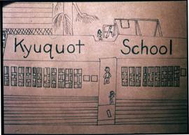
Image of a drawing by the Kyuquot Elementary School children titled "Kyuquot School".
Image of a drawing by the Kyuquot Elementary School children titled "Kyuquot School".
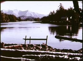
An image showing the Kyuquot Sound from the beach shore with houses and mountains in the background. According to the documentation included with the filmstrip, the description of the image states "Looking out toward Kyuquot Sound."
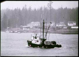
An image showing a fishing boat passing by near a village, houses and woods in the background. According to the documentation included with the filmstrip, the description of the image states "There is going to be a storm. A seine boat travelling up the coast seeks shelter in Kyuquot. In the top of the frame is the Indian Reserve."
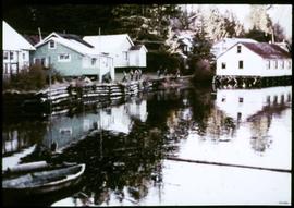
An image showing various houses near the water with people in the distance, the house on the right is built on wooden beams. According to the documentation included with the filmstrip, the description of the image states "The white building on pilings is the store and Post Office. Can you see the last dugout canoe made in Kyuquot?"
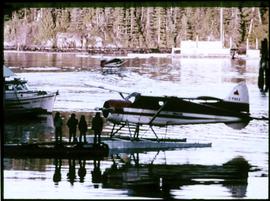
An image showing people standing on a dock next a to a sea plane with a boat nearby. Another plane in taking off in the background. According to the documentation included with the filmstrip, the description of the image states "Waiting for the afternoon scheduled flight of a "Beaver" float plane. Float planes come in twice a day (weather permitting) and bring passengers, freight, and mail."
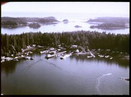
An image of an aerial view of the Kyuquot village. According to the documentation included with the filmstrip, the description of the image states "Kyuquot from the air. You can see Walter's Island and out into the Pacific Ocean. The next Island to the right is Aktis Island, the ancestral home of the Kyuquot Band. In the early 1800's the Kyuquot Band was the largest on the West Coast of Vancouver Island. However one night in 1855 the Clayoquots, enemies to the Kyoquots, surprised the Kyuquot Village on Atkis Isl., cut off the heads of the Kyuquot warriers, took the women as slaves, and set fire to the village. Most of the village was destroyed during this, the last tribal war fought on the West Coast of Vancouver Island. A few years ago most of the Kyuquot Band left Atkis Island and moved into Walter's Cove."
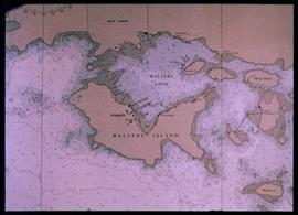
Nautical chart of Walters Island
An image showing a sea map of Walters Island, a small blue circle at the top center indicates the approximate location of the Kyuquot village. According to the documentation included with the filmstrip, the description of the image states "Kyuquot as shown on chart (A chart is a sea-map used by fishermen and boaters.) Compare the chart and the map."
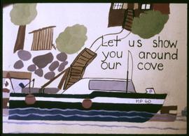
Let Us Show You Around Our Cove
Image of a drawing by the Kyuquot Elementary School children titled "Let us show you around our cove".
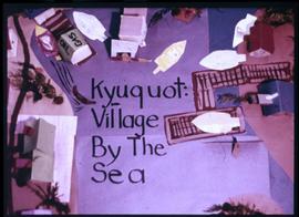
Image of a model constructed by the Kyuquot Elementary School children titled "Kyuquot: Village by the Sea."