Programme for an "Indian Musical Festival, held yearly. Three bands competing: Chiniki, Wesley and Bearpaw Bands." Includes times of performances and songs sung. Songs are mostly Christian hymns.
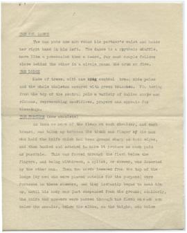
Document describing the Owl Dance, a lodge, and a method of torture. The specific culture/place related to these descriptions is not clear. "Catlin" is written at the bottom, either as the author of the document or the source of the information.
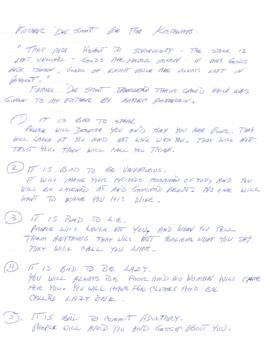
Document contains an account of a visit to Cardston, Alberta, likely to St. Paul's St. Paul's Anglican Residential School on the Blood reserve. The author of the document is unknown.
File contains photocopies of correspondence received by Fred Ryckman and photocopies of newspaper articles relating to members of the First Nations whom Ryckman came into contact with as a result of his work as well as materials relating to Ryckman himself.
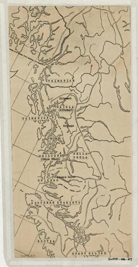
Item is copied base map with added notations showing location and extent of Tsimshian, Kwakiutl, Nootka, Coast Salish and Bella Coola territories. Includes some place names. Base map: Cental coast base map, Duff-CM-5. Encapsulated.
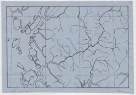
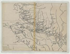
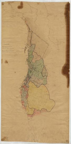
Item is a base map with added notations showing territories of South Kwakiutl tribes; former and present villages; and non-Indian settlements. Includes legend. All typed names of tribes and villages have been crossed through with pencil. Item appears to be a working copy or preliminary draft of item #40. Sheets originally taped together. Encapsulated. Base map: Southern Kwakiutl base map, Duff-CM-14.
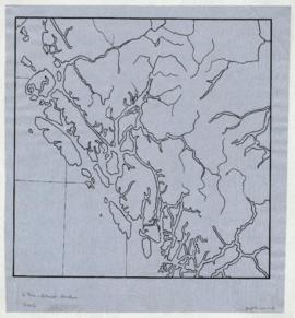
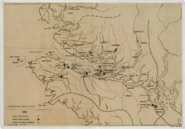
Item is a base map with ms. additions showing territories and names of South Kwakiutl tribes, names and locations of former and current villages, and non-Indian settlements. Includes legend. Marked "W. Duff 1966." Encapsulated. Base map: Southern Kwakiutl base map, Duff-CM-14.
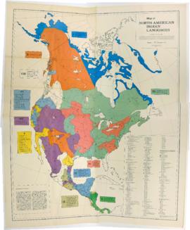
Item is a published map that shows the distribution and extent of 10 major North American language families and subdivisions. Faded and perforated.Published by Rand McNally for American Ethnological Society, 1966.
Item consists of outline map coloured to show eastward and westward influences on First Nations people in British Columbia and northwestern U.S. Stained. Encapsulated.
Item is a published map with ms. notations showing the Tlingit, Haida, Kwakiutl, Nootka, Kargani, Tsetsaut, Tahltan, Selani, Carrier, and Chilcotin. Annotations also show village names. Inset: Canada.
![Cardston [Residential School visit]](/uploads/r/null/4/c/9/4c9abbb66dd032cce0103dc4a3e98eeaa0c466d6744b98c6c6d594fe9d6787a7/JT_02_013_142.jpg)

![Ledger Book [Original & Copies]](/uploads/r/null/d/f/f/dff1ceda4bdbc63258632cdf3c121521fd8c38b9ef4102e70ab4981f5a6fa497/Ryckman_File_1_LedgerBook_142.jpg)
![Articles and Correspondence [Photocopies]](/uploads/r/null/4/d/4/4d4030560d33a7fc518cb2490689d9c17dffc410b8b4b71672f62cbbf6be7dcb/Ryckman_File_3_ArticlesAndCorrespondence_142.jpg)