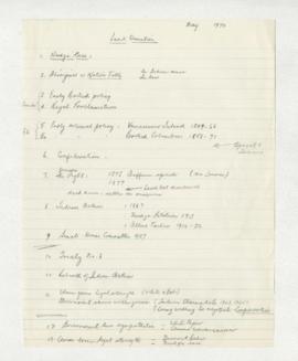
The Chilcotin war: events and possible causes by Bruce Livingston
- 29-6-D-100
- File
- [19-]
Part of Wilson Duff fonds
93 results with digital objects Show results with digital objects
The Chilcotin war: events and possible causes by Bruce Livingston
Part of Wilson Duff fonds
The cannibal raven in myth and ritual by Sari Werner
Part of Wilson Duff fonds
The best of both worlds: modes of experience in Amerindian and Western culture by Carlis Nixon
Part of Wilson Duff fonds
The Bella Bella - a bibliographic essay by Elsie MacLeod
Part of Wilson Duff fonds
The Atlatl on the northwest coast by Allan McMillan
Part of Wilson Duff fonds
The art of Salish weaving by Jennifer Stewart
Part of Wilson Duff fonds
Part of Wilson Duff fonds
Part of Wilson Duff fonds
Text of Kitwancool sign by Peter Allik Petersenn
Part of Wilson Duff fonds
Territory, reserves and village sites of
Part of Wilson Duff fonds
Item is a published map with ms. additions. Notations consist of attached typed labels showing village sites of Kwawkewlth territory, and some acreage. Marked "Map 4." Encapsulated. Base map: Sheet 92 L/11 West Port McNeill, Rupert District, British Columbia. -- 2nd ed. / published by the Army Survey Establishment, Ottawa, 1958.
Territory and reserves, and village sites of Kwawkewlth
Part of Wilson Duff fonds
Item is a published map with ms. additions. Notations consist of attached typed labels showing village sites, reserve numbers and acreage. Marked "Map 5." Encapsulated. Base map: Sheet 92 L/11 East : Port McNeill, British Columbia. -- 2nd ASE ed. / published by the Army Survey Establishment, R.C.E., Ottawa, 1958.
Part of Wilson Duff fonds
Item is a copied map that shows Kitwancool territories and villages, rivers and lakes referred to in "Territories of the Kitwancool" chapter in Histories, Territories, and Laws of the Kitwancool. Title taken from duplicate found in Histories. Encapsulated.
Part of Wilson Duff fonds
Part of Wilson Duff fonds
Item is a copied map that shows territorial boundaries of Northwest coast native people. Added notations identify Tlingit, Tsimshian and Haida territories and clans.
Copy of portion of map titled British Columbia Native Indians, Distribution of Ethnic Groups - 1850, Duff-CM-45. Encapsulated.
Part of Wilson Duff fonds
Tapes from Vancouver Art Gallery for Exhibit
Part of Wilson Duff fonds
Talk on the Indian land question
Part of Wilson Duff fonds
Symposium on ethics in anthropology field work
Part of Wilson Duff fonds
Part of Wilson Duff fonds
Suggested relations to the Fraser River Culture complex by Gerald Turnbull
Part of Wilson Duff fonds