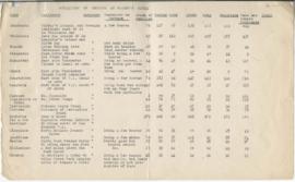
Pages 8-10 - Census of Indigenous tribes
- 29-12-04-h
- Item
Parte de Wilson Duff fonds
Pages 8-10 - Census of Indigenous tribes
Parte de Wilson Duff fonds
Parte de Wilson Duff fonds
Item consists of Duff's notes that became the key for the map of "Population and Economic Life." See File 4, page 14 (item i)
Pages 4-6 - Indigenous population
Parte de Wilson Duff fonds
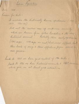
Item consists of Duff's reasons for using the year 1835 as a benchmark
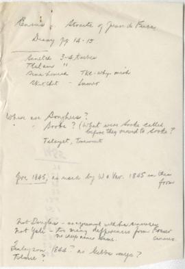
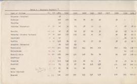
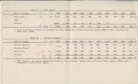
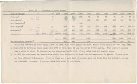
Pages 26-30 - Census- Straits of Juan de Fuca
Parte de Wilson Duff fonds
Pages 23-26 - Indigenous population of Fraser River, 1839
Parte de Wilson Duff fonds
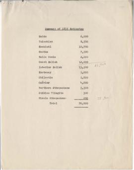
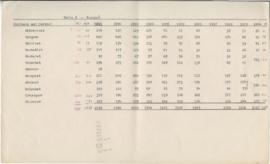
Pages 2-3 - Summary of 1835 population distribution estimates
Parte de Wilson Duff fonds
Pages 20-21 - Indigenous occupations
Parte de Wilson Duff fonds
Item consists of information used on map on page 14 (item i)
Pages 19-21 - Kwakwaka’wakw population
Parte de Wilson Duff fonds
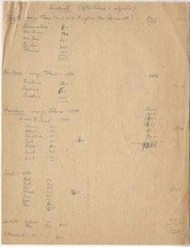
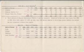
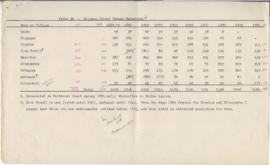
Pages 16-18 - Carrier censuses
Parte de Wilson Duff fonds
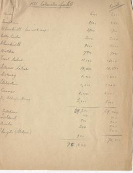
Pages 14-17 - 1835 Estimates for BC
Parte de Wilson Duff fonds
Page 9 - Nuu-chah-nulth (nootka) population
Parte de Wilson Duff fonds
Page 8 - Southern kwakwaka'wakw population
Parte de Wilson Duff fonds
Page 7 - Bella Coola and Northern kwakwaka'wakw population
Parte de Wilson Duff fonds
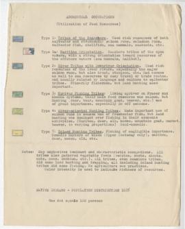
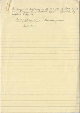
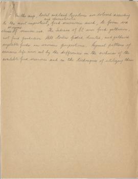
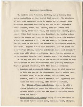
Page 7 - Aboriginal occupations (Utilization of food resources)
Parte de Wilson Duff fonds
Item consists of descriptions of Indigenous people which appear on the completed map (page 14)
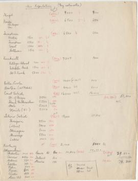
Page 6- 1800 Population (My estimates)
Parte de Wilson Duff fonds
Page 6 - Coast Tsimshian population
Parte de Wilson Duff fonds
Page 5 - Tsimshian of Lower Skeena population
Parte de Wilson Duff fonds
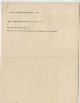
Page 5 - Key to map of BC's Indigenous population distribution in 1835 (Item d)
Parte de Wilson Duff fonds
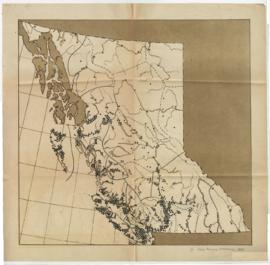
Page 4 - Map depicting BC's Indigenous population distribution in 1835
Parte de Wilson Duff fonds
Item consists of a map depicting BC's Indigenous population distribution in 1835
Page 4 - Gitxsan (Upper Skeena Tsimshian) population
Parte de Wilson Duff fonds