Prints from M. Barbeau’s “Totem Poles” and others
- 29-9-F-01
- Dossiê
- [197-?]
Parte de Wilson Duff fonds
13499 resultados com objetos digitais Mostrar resultados com objetos digitais
Prints from M. Barbeau’s “Totem Poles” and others
Parte de Wilson Duff fonds
Negatives from M. Barbeau’s “Totem Poles” and others
Parte de Wilson Duff fonds
Parte de Wilson Duff fonds
Map is marked "Resources Base."
Parte de Wilson Duff fonds
Map is marked "8 mi base."
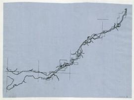
Parte de Wilson Duff fonds
Parte de Wilson Duff fonds
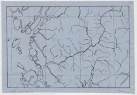
Map is marked "GG Salish" and "10 mi. base."
Parte de Wilson Duff fonds
Item is printed map with ms. additions. Notations include shaded areas showing Tlingit, Haida and Nootka territories; boundary outlines of Tsimshian, Kwakiutl, and Coast Salish territories; Tsimshian, Kwakiutl and Coast Salish place names; and geographic locations. Perforated for loose leaf binder. Encapsulated.
Parte de Wilson Duff fonds
Item is a copied topographic map with ms. additions showing the territories of British Columbia native people. Notations may be in Duff's hand. Encapsulated.
Parte de Wilson Duff fonds
Item is a copied map with ms. additions that shows geographic places and South Kwakiutl settlements. Includes photocopy.Some of the original affixed place name labels have become detached and have been placed in accompanying envelope; others are missing. Photocopy incompletely labelled, but shows original positions of some detached labels.
Parte de Wilson Duff fonds
Item is a published map with ms. additions. Notations consist of lines and affixed labels identifying location and boundaries of Nahkwockto and Kwawkewlth territories. Marked "Map 1." Typed labels affixed with tape. Encapsulated. Base map: 92L : Alert Bay, British Columbia. -- 1st ed. / produced by the Army Survey Establishment, R.C.E., Department of Mines and Technical Surveys, Ottawa, 1965.
Territory, reserves and village sites of
Parte de Wilson Duff fonds
Item is a published map with ms. additions. Notations consist of attached typed labels showing village sites of Kwawkewlth territory, and some acreage. Marked "Map 4." Encapsulated. Base map: Sheet 92 L/11 West Port McNeill, Rupert District, British Columbia. -- 2nd ed. / published by the Army Survey Establishment, Ottawa, 1958.
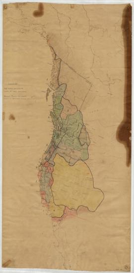
Tsimshian territories / drawn by Wilson Duff
Parte de Wilson Duff fonds
Item is a map that shows Tsimshian territories, tribes, villages and sites, marked by arabic numbers. Includes Roman numerals indicating the territory of chiefs, by rank. Item appears to be a consolidation of information derived from the files of Marius Barbeau. Duff intended to produce a complete description of the social structure of Tsimshian tribes, and for that purpose mapped territories and village sites found in Barbeau's work. In English and Tsimshian. Photocopy available, Duff-CM-46. Duff refers to this project in a 1964 article (Anthropologica 1964:1, available in box 2, file 8) and in a progress report letter to Charles E. Borden, dated November 15, 1958 (available in Borden's papers, Box 51, file 49, U.B.C. Special Collections).
Parte de Wilson Duff fonds
Item is a copied base map with ms. additions showing location of reserve areas. Notations in Duff's hand. Encapsulated. Base map: Southeast Vancouver Island base map, Duff-CM-22.
Three reserves of the Spallumacheen Band
Parte de Wilson Duff fonds
Item is a published topographic map with ms. additions showing the location and extent of Spallumacheen reserves. Marked "C. Saunders 1195682." Spelling of band name in notation differs from spelling on base map. Base map: 82L : Vernon, British Columbia, West of sixth meridian. -- 1st ed. / produced by the Army Survey Establishment, Mines and Technical Surveys, Ottawa, 1966.
Parte de Wilson Duff fonds
Item consists of two published maps, taped together, with ms. additions. Notations include broken lines indicating the boundaries of reserves of the Ohiaht tribe of the Nootka family, and numbering of the reserves located in Barkley Sound area of Vancouver Island. Title taken from notation, on verso: "Roslyn Ellison, Ohiaht Band Reserves D2." Base maps: Sheet 92 C/14 : Barkley Sound, British Columbia. -- 2nd ed. / published by Army Survey Establishment, Ottawa, 1956; Sheet 92 C/15 : Nitinat, British Columbia / revised and printed by Army Survey Establishment, Ottawa, 1955. Faded; tape yellowed and loosening.
Parte de Wilson Duff fonds
Item is a map photocopied between 1960 and 1976. It is a British Museum reproduction of map printed by J. Arrowsmith, London, 1849.
Northwest coast and plains influences
Parte de Wilson Duff fonds
Item consists of outline map coloured to show eastward and westward influences on First Nations people in British Columbia and northwestern U.S. Stained. Encapsulated.
Parte de Wilson Duff fonds
Item is a published map with ms. notations showing the Tlingit, Haida, Kwakiutl, Nootka, Kargani, Tsetsaut, Tahltan, Selani, Carrier, and Chilcotin. Annotations also show village names. Inset: Canada.
Labret with appendage (QAA 922)
Parte de Wilson Duff fonds
Parte de Wilson Duff fonds