- 29-10-A-11
- Dossier
- 1965-1976
Fait partie de Wilson Duff fonds
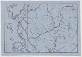
Map is marked "8 mi base."
Fait partie de Wilson Duff fonds
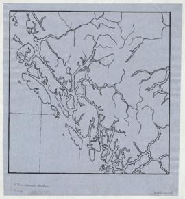
Map is marked "8 mi base."
Fait partie de Wilson Duff fonds
Fait partie de Wilson Duff fonds
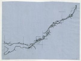
Map is marked "16 mi."
Fait partie de Wilson Duff fonds
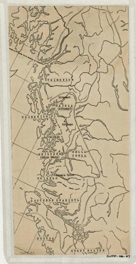
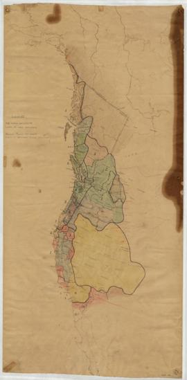
Item is copied base map with added notations showing location and extent of Tsimshian, Kwakiutl, Nootka, Coast Salish and Bella Coola territories. Includes some place names. Base map: Cental coast base map, Duff-CM-5. Encapsulated.
Fait partie de Wilson Duff fonds
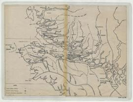
Item is a base map with added notations showing territories of South Kwakiutl tribes; former and present villages; and non-Indian settlements. Includes legend. All typed names of tribes and villages have been crossed through with pencil.
Item appears to be a working copy or preliminary draft of item #40. Sheets originally taped together.
Encapsulated. Base map: Southern Kwakiutl base map, Duff-CM-14.
Southern Kwakiutl villages and tribes
Fait partie de Wilson Duff fonds
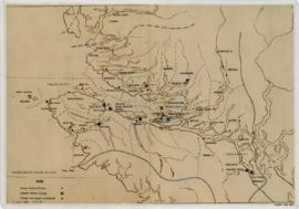
Item is a base map with ms. additions showing territories and names of South Kwakiutl tribes, names and locations of former and current villages, and non-Indian settlements. Includes legend. Marked "W. Duff 1966." Encapsulated.
Base map: Southern Kwakiutl base map, Duff-CM-14.
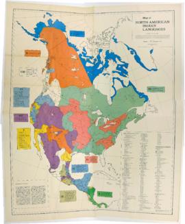
Map of North American Indian Languages /compiled by C.F. and F.M. Voegelin
Fait partie de Wilson Duff fonds
Item is a published map that shows the distribution and extent of 10 major North American language families and subdivisions. Faded and perforated.Published by Rand McNally for American Ethnological Society, 1966.
Northwest coast and plains influences
Fait partie de Wilson Duff fonds
Item consists of outline map coloured to show eastward and westward influences on First Nations people in British Columbia and northwestern U.S. Stained. Encapsulated.
Fait partie de Wilson Duff fonds
Item is a published map with ms. notations showing the Tlingit, Haida, Kwakiutl, Nootka, Kargani, Tsetsaut, Tahltan, Selani, Carrier, and Chilcotin. Annotations also show village names. Inset: Canada.
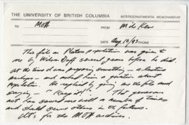
Page 1 - Memo from Michael Kew
Fait partie de Wilson Duff fonds
Item consists of a memo from Michael Kew stating that this file was given to him by Wilson Duff
Page 2 - Duff's memo on how to use population information
Fait partie de Wilson Duff fonds
Item consists of a memo regarding how to use population information
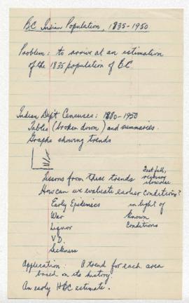
Page 3 - BC Indigenous population, 1835-1950
Fait partie de Wilson Duff fonds
Item consists of Duff's notes on how to arrive at an estimation of BC'S Indigenous population from 1835 to 1950
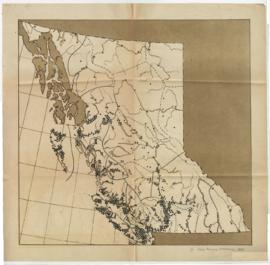
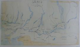
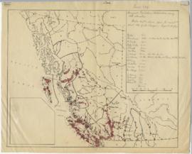
Page 4 - Map depicting BC's Indigenous population distribution in 1835
Fait partie de Wilson Duff fonds
Item consists of a map depicting BC's Indigenous population distribution in 1835
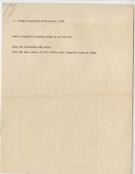
Page 5 - Key to map of BC's Indigenous population distribution in 1835 (Item d)
Fait partie de Wilson Duff fonds
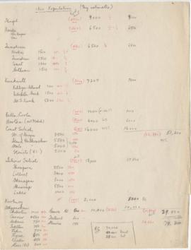
Page 6- 1800 Population (My estimates)
Fait partie de Wilson Duff fonds
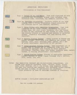
Page 7 - Aboriginal occupations (Utilization of food resources)
Fait partie de Wilson Duff fonds
Item consists of descriptions of Indigenous people which appear on the completed map (page 14)
Pages 8-10 - Census of Indigenous tribes
Fait partie de Wilson Duff fonds
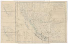
Page 11 - Indigenous population distribution, using 1835 estimates
Fait partie de Wilson Duff fonds
Item consists of Duff's hand-drawn map of winter population distribution
Page 12 - Population distribution map of winter villager sites, 1835
Fait partie de Wilson Duff fonds
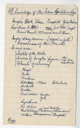
Page 13 - HB knowledge of the Indigenous population figs
Fait partie de Wilson Duff fonds