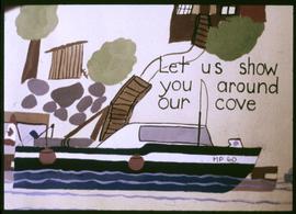
Let Us Show You Around Our Cove
- 148-02-a035782
- Item
- 1975 or 1976
Image of a drawing by the Kyuquot Elementary School children titled "Let us show you around our cove".
252 results with digital objects Show results with digital objects
Let Us Show You Around Our Cove
Image of a drawing by the Kyuquot Elementary School children titled "Let us show you around our cove".
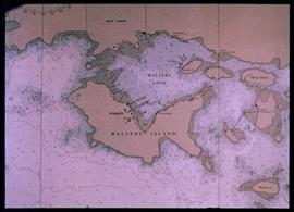
Nautical chart of Walters Island
An image showing a sea map of Walters Island, a small blue circle at the top center indicates the approximate location of the Kyuquot village. According to the documentation included with the filmstrip, the description of the image states "Kyuquot as shown on chart (A chart is a sea-map used by fishermen and boaters.) Compare the chart and the map."
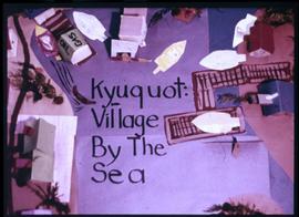
Image of a model constructed by the Kyuquot Elementary School children titled "Kyuquot: Village by the Sea."