- 25-04-08-a038446
- Item
- [197-?]
Parte deAnthony Carter fonds
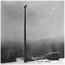
Image of a bear pole in Kitwancool, BC. This pole is pictured on page 119 of Carter's book Abundant Rivers.
Sin título
48 resultados con objetos digitales Muestra los resultados con objetos digitales
Parte deAnthony Carter fonds
Image of a bear pole in Kitwancool, BC. This pole is pictured on page 119 of Carter's book Abundant Rivers.
Sin título
Sub-series consists of mostly textual records in addition to photographs, negatives, slides and contact sheets. The textual records are both handwritten and typed notes, as well as publications of other authors. Research topics undertaken by Halpin include Tsimshian art, Marius Barbeau’s work, the Kitwancool, Gitksan art and William Beynon. Photographs and negatives are mostly of masks, totem poles and rattles.
Kitwancool Laxse'l xiii:2, xii:3
Ketchikan and Kitwancool Totems and Views
Parte deMinn Sjolseth fonds
File consists of slides depicting totems and views labeled as in Kispiox, Kitwancool, Ketchikan, Haida, Kitseguckla, Skedans, and Kingcome. File also consists of slides documenting two of Minn Sjolseth's paintings entitled "En av de Siste" (sp?) and "Peace."
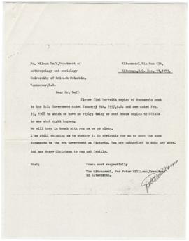
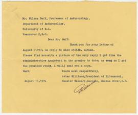
Parte deWilson Duff fonds
Peter Williams, President of Kitwancool
Parte deWilson Duff fonds
Histories, territorial laws of the Kitwancool
Parte deWilson Duff fonds
Parte deWilson Duff fonds
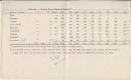
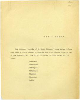
Page 4 - Gitxsan (Upper Skeena Tsimshian) population
Parte deWilson Duff fonds
Parte deWilson Duff fonds
Parte deWilson Duff fonds
Parte deWilson Duff fonds
Parte deWilson Duff fonds
Parte deWilson Duff fonds
Parte deWilson Duff fonds
Parte deWilson Duff fonds
File consists of slides including: Kitwancool, Kitselas, Kitwanga, Kispiox, b&w slides of Kitsegukla, Gitksan grave markers.
Parte deWilson Duff fonds
Maps created, acquired, and used by Duff in his research and teaching activities. The materials show geographical features; location and boundaries of territories and villages of Northwest coast native people; reserves; language families and distribution, influences, and historical features. Included are ms. maps; and copied, traced, outline and published maps, most with added ms. notations.
The Base maps sub-series consists of topographic maps produced as bases for the creation of other maps to show the locations and territorial boundaries of native people within British Columbia. Maps include ms. notations by Duff.
The Territory maps sub-series consists of ms. maps; and base, outline, copied and photocopied maps with ms. notations. Items show location and boundaries of native territories in British Columbia and the United States. Includes maps showing extent and detail of Tsimshian territory; Kispiox sites; Kitwancool territory and sites; South Kwakiutl territory, villages and tribes. Notations identify some place names and villages.
The Reserve maps sub-series consist of copied and published maps with ms. notations showing the location and extent of various reserves. Some acreage is also included.
The Miscellaneous Maps sub-series consists of published, copied and outline maps showing language families in North America, influences on British Columbia native people, historical distribution of native people in B.C., and Vancouver Island in the 19th century.