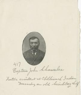
Image is an oval head and shoulders portrait of a man identified in an inscription below the image as Captain John Shawalas. An additional handwritten inscription reads "native assistant at Chilliwack Indian Mission, an old hereditary chief".
Chilliwack
4 Archival description results for Chilliwack
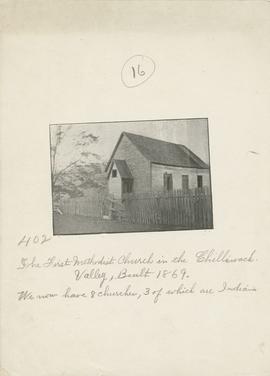
Image is an exterior view of a church building. Inscribed below the image is "The first methodist church in the Chilliwack Valley, built 1869. We now have 8 churches, 3 of which are indian".
This file contains a letter and published map created and sold by Oliver N. Wells that was shared with Wilson Duff. According to the title of the map, "Indian Territory 1858", it depicts Stó:lō and Nooksack territories circa 1858, with the lands of the "Chilliwack Tribe" [Ts’elxwéyeqw] being the central focus.
The map and its enclosure include information about villages, geography, trails, and culturally important sites around S’ólh Téméxw. It also includes approximate pronunciations for halq’eméylem place names and their translations in English.
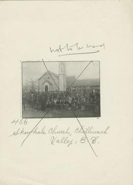
Image is a posed group portrait in front of a church building. Location is identified in a handwritten inscription below the image as Chilliwack Valley, B. C. Image has been crossed out in pencil and the words "not to be used" are inscribed above the image.