- 29-5-18
- File
- [196-?]
Part of Wilson Duff fonds
Part of Wilson Duff fonds
The War History of the Grizzly Bear People of the Kitselas People as Told by Chief Neas D. Hok
Part of Wilson Duff fonds
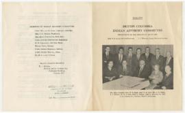
B.C. Indian Advisory Committee
Part of Wilson Duff fonds
Totem Poles of the Upper Skeena
Part of Wilson Duff fonds
![Ledger Book [Original & Copies]](/uploads/r/null/d/f/f/dff1ceda4bdbc63258632cdf3c121521fd8c38b9ef4102e70ab4981f5a6fa497/Ryckman_File_1_LedgerBook_142.jpg)
Ledger Book [Original & Copies]
Part of Fred Ryckman fonds
File contains a ledger book and photocopies of it. The ledger book was written by Fred Ryckman ca. 1920 and includes census information by location.
Fred Ryckman
![Articles and Correspondence [Photocopies]](/uploads/r/null/4/d/4/4d4030560d33a7fc518cb2490689d9c17dffc410b8b4b71672f62cbbf6be7dcb/Ryckman_File_3_ArticlesAndCorrespondence_142.jpg)
Articles and Correspondence [Photocopies]
Part of Fred Ryckman fonds
File contains photocopies of correspondence received by Fred Ryckman and photocopies of newspaper articles relating to members of the First Nations whom Ryckman came into contact with as a result of his work as well as materials relating to Ryckman himself.
Fred Ryckman
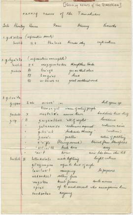
List of Naxncq names of all Tsimshian
Part of Wilson Duff fonds
Part of Wilson Duff fonds
Part of Wilson Duff fonds
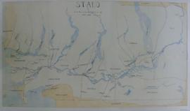
Item is a published map with ms. notations showing the Tlingit, Haida, Kwakiutl, Nootka, Kargani, Tsetsaut, Tahltan, Selani, Carrier, and Chilcotin. Annotations also show village names. Inset: Canada.

Part of Wilson Duff fonds
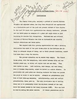
![[Histories, Territories and Laws of the Kitwancool]](/uploads/r/null/1/0/6/1061c9eb330200732e4fbd1d0428c3eed32efa8baf2dfb1fb5f2d5c86f17c015/WD46_08reduced_142.jpg)
[Histories, Territories and Laws of the Kitwancool]
Part of Wilson Duff fonds
Part of Wilson Duff fonds
Northwest coast and plains influences
Part of Wilson Duff fonds
Item consists of outline map coloured to show eastward and westward influences on First Nations people in British Columbia and northwestern U.S. Stained. Encapsulated.
Part of Wilson Duff fonds
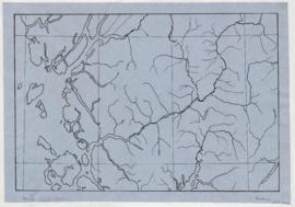
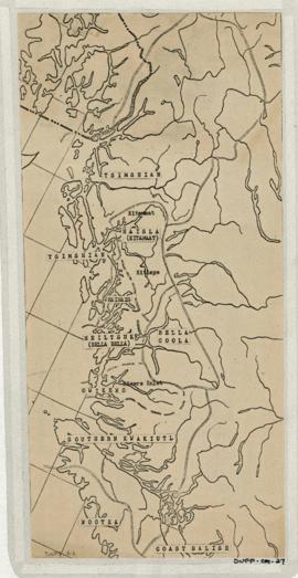
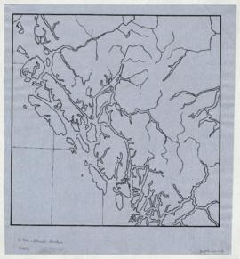
Item is copied base map with added notations showing location and extent of Tsimshian, Kwakiutl, Nootka, Coast Salish and Bella Coola territories. Includes some place names. Base map: Cental coast base map, Duff-CM-5. Encapsulated.
Anthropology 502 Ethnohistory sessions
Part of Wilson Duff fonds
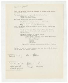
Anthropology 502 Ethnohistory (culture) (502-5)
Part of Wilson Duff fonds
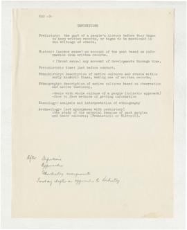
Anthropology 502 Duff approaches (502-2)
Part of Wilson Duff fonds
Part of Wilson Duff fonds
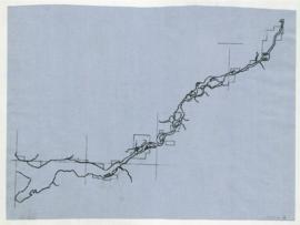
Map is marked "16 mi."
Part of Wilson Duff fonds
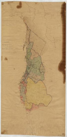
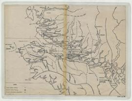
Item is a base map with added notations showing territories of South Kwakiutl tribes; former and present villages; and non-Indian settlements. Includes legend. All typed names of tribes and villages have been crossed through with pencil.
Item appears to be a working copy or preliminary draft of item #40. Sheets originally taped together.
Encapsulated. Base map: Southern Kwakiutl base map, Duff-CM-14.