- 28-02-GG-13
- File
- 1996
Part of David Cunningham fonds
13493 results with digital objects Show results with digital objects
Part of David Cunningham fonds
File contains images of the text that was used as well as images of the exhibit <i>Show and Tell: The Story of the Big Mac Box</i>. In addition there are two images on the contact sheet that show a different exhibit titled <i>Blood from Stone</i>.
Part of David Cunningham fonds
Part of Madeline Bronsdon Rowan fonds
1 hand-drawn poster : black and red ink on white-faced cardboard, with highlights in blue watercolour and tracings in pencil.
‘NOT' highlighted in red; ‘FENCES' highlighted in blue watercolour.
File contains photocopies of images of some of the silver work featured in the <i>Signed withot Signature: Works by Charles and Isabella Edenshaw</i> exhibit.
Teslin traditional storytelling and singing by George Johnson
Part of MOA General Media collection
Item is an audio recording of George Johnston (Tlingit name was Kaash KlaÕ) at age 80 singing and speaking in either Haida or Tlingit. He was a hunter, trapper, entrepreneur and photographer and was known for documenting his family life and the Yukon community of Teslin, where he lived. For biographical information see http://www.nutaaq.com/productions/georgejohnston.html
Terry Point Creek Tour July 24/02 1hr. 7min.
Part of Rosa Ho fonds
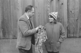
Terry from Johnson wipes his hands after assessing the situation
Part of Ronnie Tessler fonds
Image is of Terry from Johnson wiping his hands and speaking with Reva next to longhouse.
Territory, reserves and village sites of
Part of Wilson Duff fonds
Item is a published map with ms. additions. Notations consist of attached typed labels showing village sites of Kwawkewlth territory, and some acreage. Marked "Map 4." Encapsulated. Base map: Sheet 92 L/11 West Port McNeill, Rupert District, British Columbia. -- 2nd ed. / published by the Army Survey Establishment, Ottawa, 1958.
Part of Wilson Duff fonds
Territory and reserves, and village sites of Kwawkewlth
Part of Wilson Duff fonds
Item is a published map with ms. additions. Notations consist of attached typed labels showing village sites, reserve numbers and acreage. Marked "Map 5." Encapsulated. Base map: Sheet 92 L/11 East : Port McNeill, British Columbia. -- 2nd ASE ed. / published by the Army Survey Establishment, R.C.E., Ottawa, 1958.
Part of Wilson Duff fonds
Item is a copied map that shows Kitwancool territories and villages, rivers and lakes referred to in "Territories of the Kitwancool" chapter in Histories, Territories, and Laws of the Kitwancool. Title taken from duplicate found in Histories. Encapsulated.
Part of Wilson Duff fonds
Part of Wilson Duff fonds
Item is a copied map that shows territorial boundaries of Northwest coast native people. Added notations identify Tlingit, Tsimshian and Haida territories and clans.
Copy of portion of map titled British Columbia Native Indians, Distribution of Ethnic Groups - 1850, Duff-CM-45. Encapsulated.
Part of Jennifer Kramer fonds
File consists of interview notes and full transcript.
Terraced cultivation, Shek nei Ping
Part of Stuart Schofield fonds
Shek nei Ping may be a misspelling of Chek Nai Ping. Elizabeth Johnson notes that this photo is almost certainly Shek Lei, Tsu Den Wan (Johnson 1992).